Popular Outdoor Adventures to Take on a Buffalo and Kaycee, Wyoming Vacation.
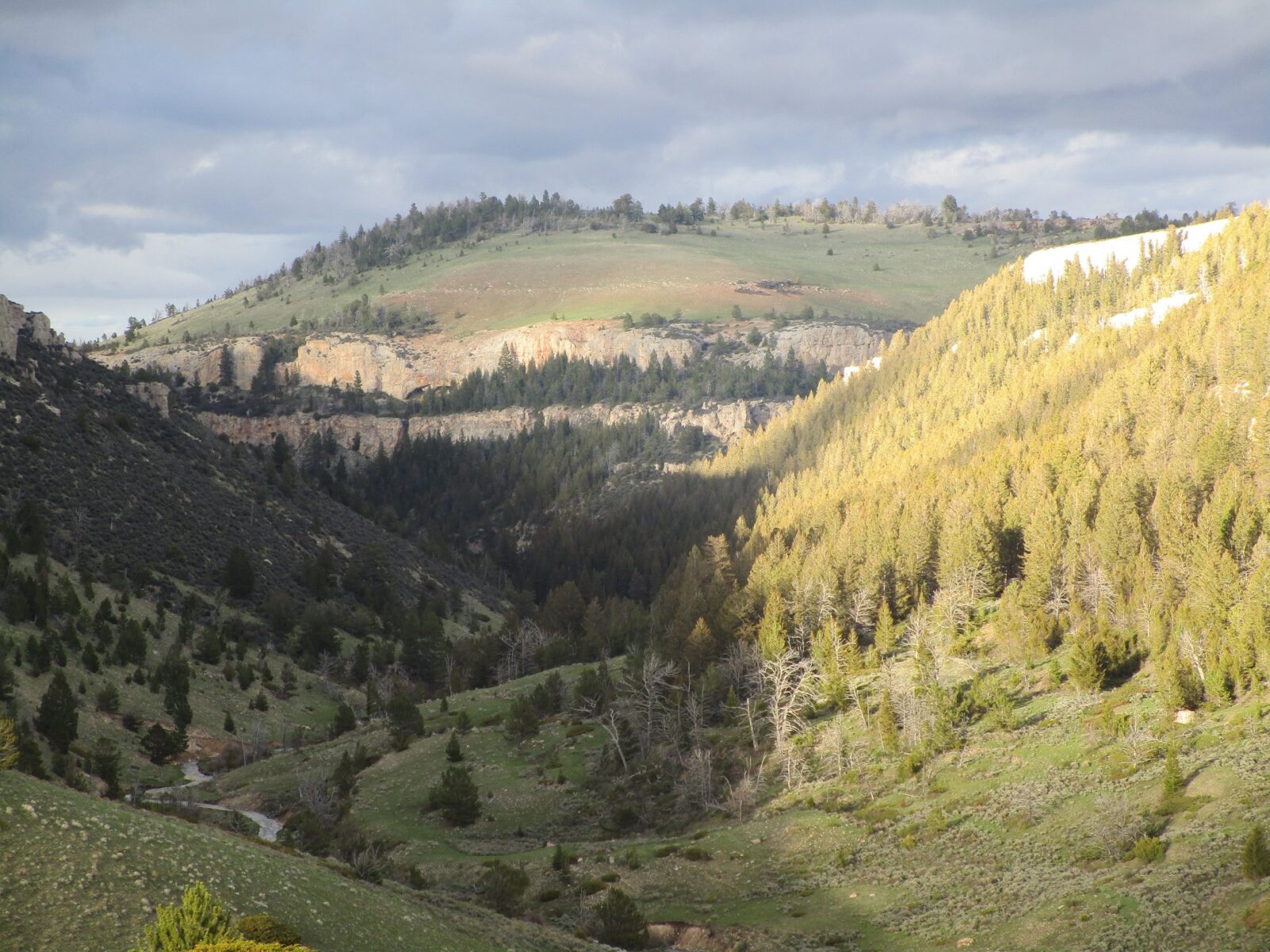
When you’re visiting Johnson County, Wyoming, you can’t miss the Bighorn Mountains. This sister range of the Rocky Mountains offers a diverse landscape with grasslands, meadows, lakes, and cliffs. When you travel to Buffalo or Kaycee, Wyoming, you’ll find trails, byways, lakes, and wilderness areas nearby to suit every type of traveler. Review our picks for big, bigger, and biggest adventures found here and start planning your trip to Wyoming today.
BIG FUN
Clear Creek Trail System
The Clear Creek Trail System is an almost 13-mile family-friendly trail stretching across the city of Buffalo. The trail begins at City Park in downtown Buffalo and ends at Mosier Gulch. Walkers, hikers, and joggers — some with canines —share the trail with bikers. The easy paved start leads to a network of progressively more technical offroad trails that challenge outdoor enthusiasts of all experience levels.
Mosier Gulch
Nestled in the foothills of the Bighorn Mountains is Mosier Gulch Recreation Area, located five miles west of Buffalo along U.S. Highway 16. The almost 900 acres of ponderosa pine-forested lands are home to mule deer, antelope, eagles, black bears, and elk. The roadside picnic area is complete with tables and pedestal fire grates. Mountain bikers can start the descent to Buffalo, or hikers can enjoy a stroll through nature following the Clear Creek Trail System from the trailhead. Plus, flyfishing is plentiful in nearby Clear Creek.
Cloud Peak Skyway
The Cloud Peak Skyway Scenic Byway travels through the southern section of the Bighorn National Forest on U.S. 16. The Skyway provides dramatic views and vistas of the surrounding wilderness and the only view of Cloud Peak, the highest peak in the Bighorn Mountains at 13,171 feet. Numerous turnouts and interpretive sites provide travelers with the opportunity to stop and appreciate the views while learning more about the area.
Hospital Hill Interpretive Site sits along the Cloud Peak Skyway just as you enter the Bighorn National Forest. Not only can you take in the breathtakingly beautiful views when you stop here, but you can also learn more about the area through the educational signs. Five colorful displays include photographs and maps to educate travelers about the wilderness, area activities, the effects of fire, and the need for sustainability to maintain our natural resources.
Tie Hack Picnic Ground is located about one mile off the Cloud Peak Skyway, situated at the north end of Tie Hack Reservoir. This reservoir is ideal for canoeing and fishing, with anglers casting for rainbow, cutthroat, brown, and brook trout. Nearby is the Circle Park Trailhead, with access to trails leading to numerous alpine lakes and two 12,000-foot-tall peaks within the Cloud Peak Wilderness. The Powder River Interpretive Site is found at Powder River Pass and offers impressive views at the highest point on Highway 16 at 9,666 feet.
Crazy Woman Canyon
Crazy Woman Canyon has a storied past beginning in the mid-1800s. This point along the Bozeman Trail served as a passageway for Native Americans, resulting in its name. Legend has it that the canyon was named after a Native American woman left behind, causing her to go insane. Visitors with high clearance vehicles can travel the 13.2-mile Crazy Woman Canyon Road that follows Crazy Woman Creek through the canyon from Powder River Basin and be rewarded with waterfalls, creeks, and cliffs. This hidden gem offers dispersed camping sites with rivers to fish and lovely landscapes to explore.
Circle Park Trailhead, Elgin Park Loop & Grommund Point
Circle Park Trailhead leads to several short hikes, including the 4.6-mile out and back trail that leads to Sherd Lake Loop Trail. Also referred to as the Circle Park Loop, this loop is a horseshoe-shaped 7.8-mile trail that takes hikers through riparian areas and rocky slopes dotted with ponds and lakes, including Sherd Lake and Rainey Lake. Elgin Park Loop offers a nice drive to view snow-capped mountains, wilderness scenery, and possibly moose. Camping sites, many with firepits, are abundant. From here, visitors can explore the Grommund Point Trail, a 4-hour hike or horseback ride.
BIGGER ADVENTURE
Cloud Peak Wilderness
Named for the tallest mountain in the Bighorn National Forest — Cloud Peak at 13,167 feet — the Cloud Peak Wilderness area, offers some of America’s most majestic alpine scenery. The 189,039-acre site preserves many sharp summits and towering sheer rock faces standing above glacier-carved, U-shaped valleys. Backpackers and hikers wander along more than 100 miles of trails tucked in a mix of pine and spruce trees with several hundred beautiful lakes to discover. Advanced hikers will want to summit Cloud Peak, a Wyoming thirteener, for amazing views from the highpoint of the Big Horn Range.
Cloud Peak Reservoir & Lake Angeline
Cloud Peak Reservoir, also referred to as Cloud Peak Lake, delights fishermen with plenty of cutthroat, brook, and rainbow trout to catch here, where chances of getting a bite are good. Angeline Trail is a 4.2-mile one-way steep climb leading to Lake Angeline, where more good fishing awaits for those up for the challenge.
Bomber Mountain Wreckage
For an unusual site, trek up to Bomber Mountain, the site of a 1943 Army Air Corp B-17 airplane crash that took the lives of 10 service members. The hike begins at West Tensleep Lake Trailhead, with a 1,100-foot elevation gain as you reach Mistymoon Lake, a great place to camp before heading on up to the wreckage. From here, hikers will pass by a couple more lakes before coming across a memorial plaque and on to Bomber Mountain.
Highland Park and Highland Lake
Highland Park is a popular place for backpackers with a large meadow situated at the base of Blacktooth Mountain, surrounded by some of the most rugged and dramatic peaks in the Bighorn Mountains. Along the trail, you’ll come upon multiple lakes, including the beautiful Highland Lake. Anglers can cast their reels in the hopes of catching pickerel, perch, smallmouth bass, largemouth bass, and white perch. Hikers will enjoy amazing views and might spot grazing elk.
Baby Wagon Trail, Elk Lake Trail & Frying Pan
Baby Wagon Trail is an excellent backcountry trail, offering hiking, ATV, and snowmobiling trails as well as fishing at Baby Wagon Creek. The Elk Lake Trail is a steep and rugged trail that ascends Ant Hill, ending at Elk Lake. While there is no fishing here, moose sightings are common. Frying Pan Lake Trail is difficult to access but leads to Frying Pan Lake, filled with rainbow and cutthroat trout.
BIGGEST CHALLENGE
Solitude Trail Loop
The Solitude Trail Loop is a 55-mile trek that circles Cloud Peak and is ideal for those craving an extreme backcountry trip. This trail fluctuates from 8,500 feet to 11,000 feet, climbing almost 10,000 feet of elevation over rocky passes and streams. Horseback riding, OHV (off-highway vehicle) trail riding, and day hikes are popular outdoor activities along this loop.

